Overview
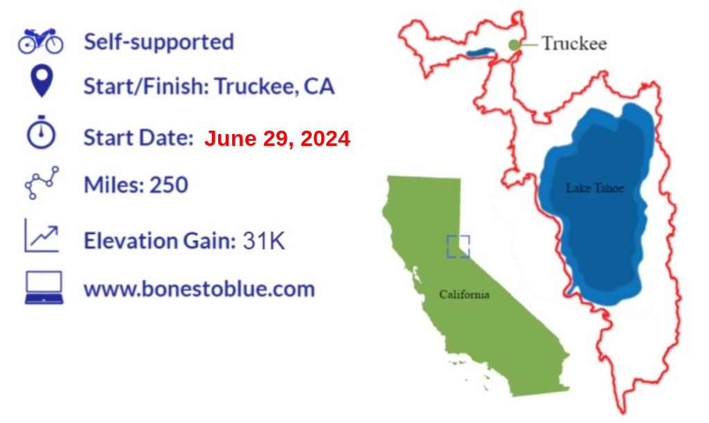
The Bones to Blue bikepacking route is ~250 miles with~31K of climbing. Consider touring it over 5-7 days or pushing your limits and racing it. The distances between food resupplies are reasonable and there is plenty of water along the route.
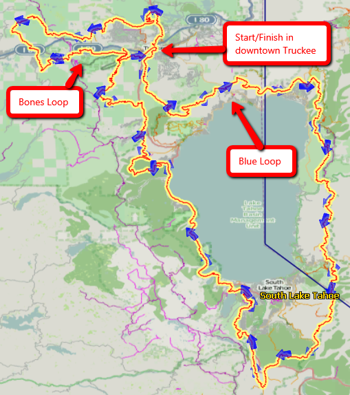
Beginning and ending in Truckee, CA, the Bones to Blue bikepacking route consists of two loops. First, a smaller loop above Truckee (Bones loop) and then a bigger loop around Lake Tahoe (Blue loop). The majority of the route is well-maintained singletrack with some fire roads. It incorporates most of the amazing singletrack trails around Truckee and Lake Tahoe: Emigrant, Animal, Tahoe Donner trails, Donner Lake Rim Trail, Jackass, Sawtooth, Western States, Tahoe Rim Trail, Incline Flume, Flume, Christmas Valley, Angora Ridge, Stanford Rock, and Yogi’s.
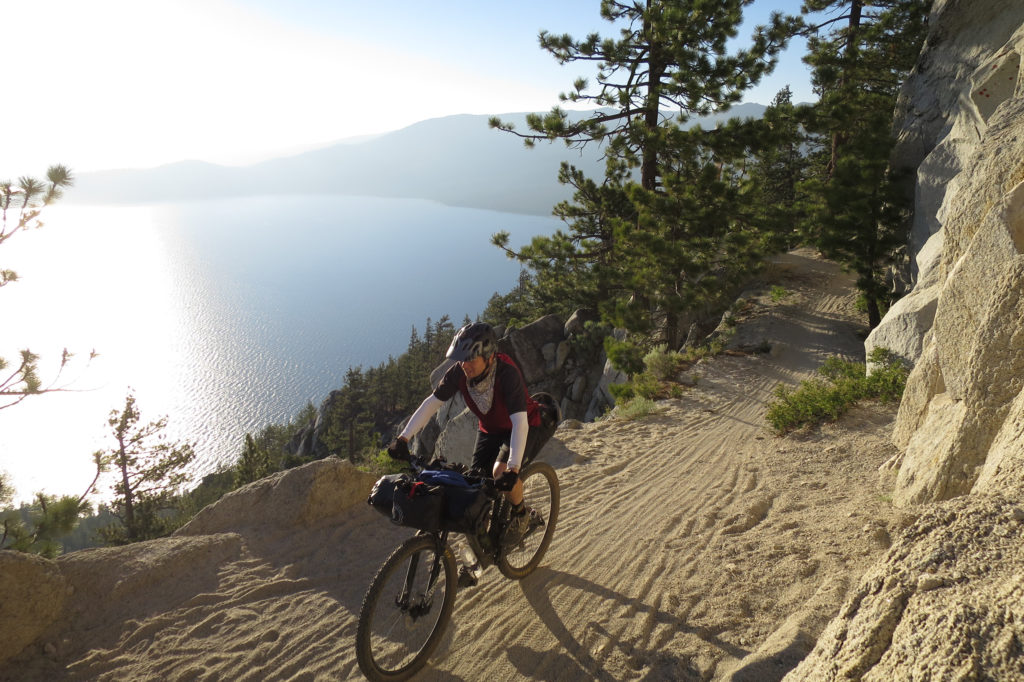
There is a 13-mile stretch of road riding along the west shore of Lake Tahoe around Emerald Bay. Though it is pavement, it’s extremely scenic.
Bones loop (above Truckee) – the route goes right through the areas that the Donner Party spent their tragic winter of 1846/47. The 89 pioneers hunkered down in 2 different areas – one group near Alder Creek and the other near Donner Lake. You will pass through the Donner family’s site at the beginning of the route and the other sites at the end of the route. You will also descend down, through the original Donner Pass train tunnels, riding over the top of the China Wall, where many Chinese laborers lost their lives doing dangerous and arduous work to connect the transcontinental railroad through the Sierras.
Blue loop (around Lake Tahoe) – this section of the route follows a lot of the bike-legal sections of the famous Tahoe Rim Trail and includes the Flume Trail. While there is a lot of climbing, the trail is very rideable and the views are stunning. You are in for a treat.
GPX Tracks & Waypoints
The Bones to Blue track and waypoints are available on Ride with GPS (click the title of the map below). You can navigate by using the RWGPS app on your phone or downloading/uploading the track and waypoint files to your GPS device.
CA and NV Base Maps for Garmin GPS devices
If you are using a Garmin eTrex GPS device, it’s helpful to have topo maps installed on your GPS device, so you can see elevation, rivers, roads, etc. along the route. If you have a PC and a Garmin GPS, follow these instructions to upload free, CA and NV maps to your device.